

All-In-One Offline Maps
Category : Maps & NavigationVersion: 3.15d
Size:7.2 MBOS : Android 2.1+
Developer:Psyberia
 Download
 OfflineMaps provides you with access to an extensive selection of maps, ensuring a seamless navigation experience without the usual distractions.
No advertisements ~ No data sharing & monetization ~ No analytics ~ No third party libraries
Tired of waiting for maps to load? With All-In-One OfflineMaps, once a map is displayed, it's stored and remains accessible instantly, even without an internet connection.
• Looking for more than just road maps? You'll find a variety of options here;
• Frequently visit areas with weak network coverage? No worries, your maps will stay available;
• Traveling internationally? Never worry about getting lost again;
• Concerned about data limits? OfflineMaps will help reduce your data consumption.
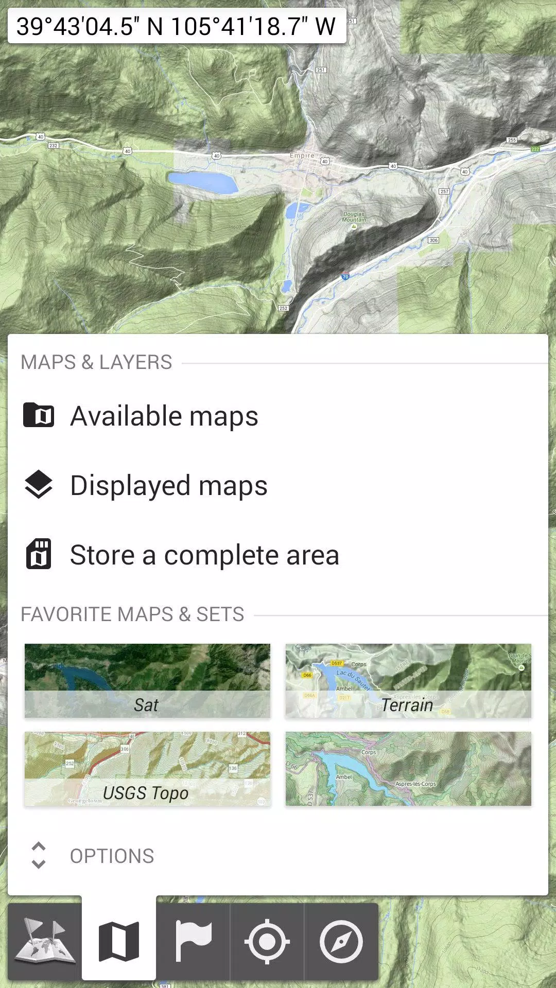
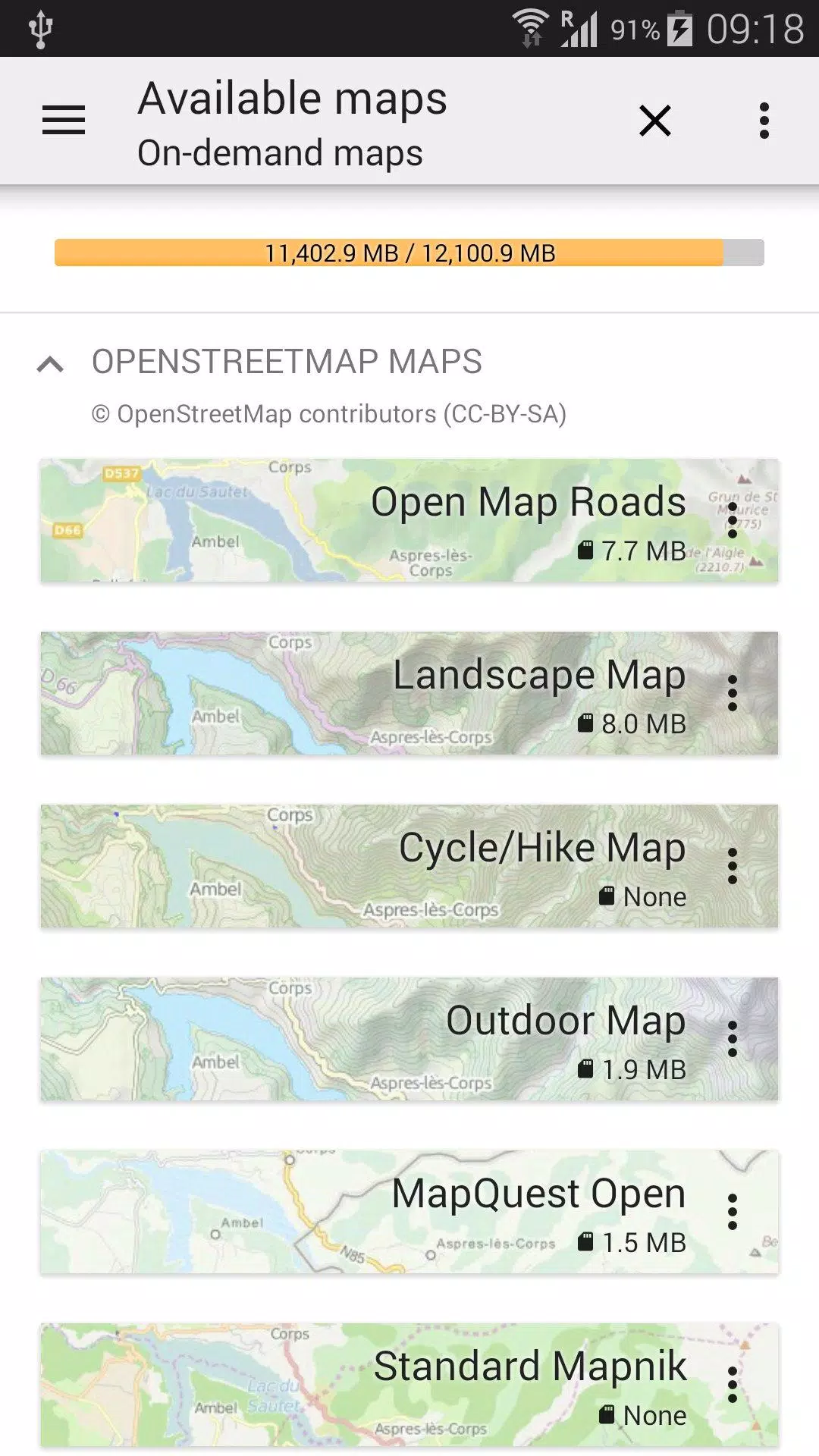
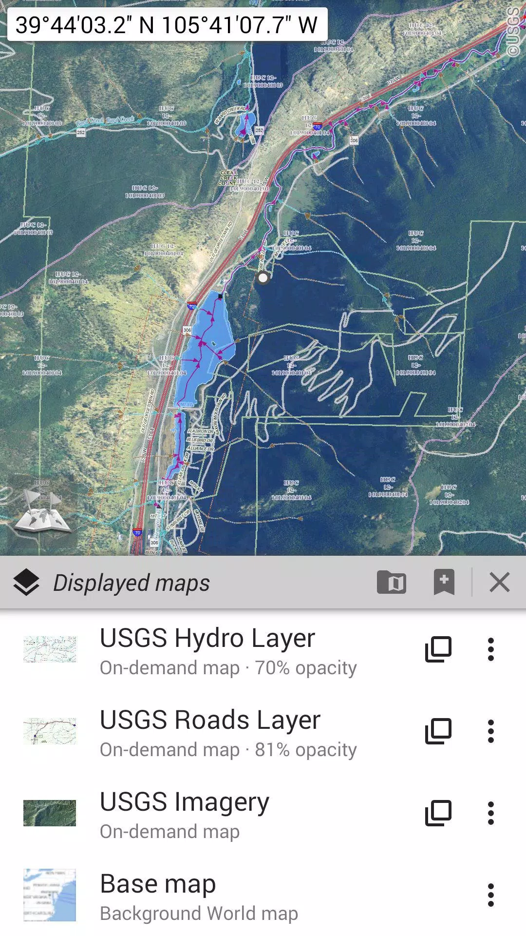
★★ Maps ★★
Explore a wide array of maps, from classic road maps to detailed topographic and aerial (satellite) maps, along with numerous additional layers you can overlay on any map: OpenStreetMap (Roads, Topo), USGS National Map (High-resolution topo, Aerial imagery), Worldwide Military Soviet topo maps, and more.
• Layer multiple maps with adjustable opacity for a customized view;
• Quickly select and save large areas with just a few clicks;
• Easily manage stored map data, with straightforward options for deletion.
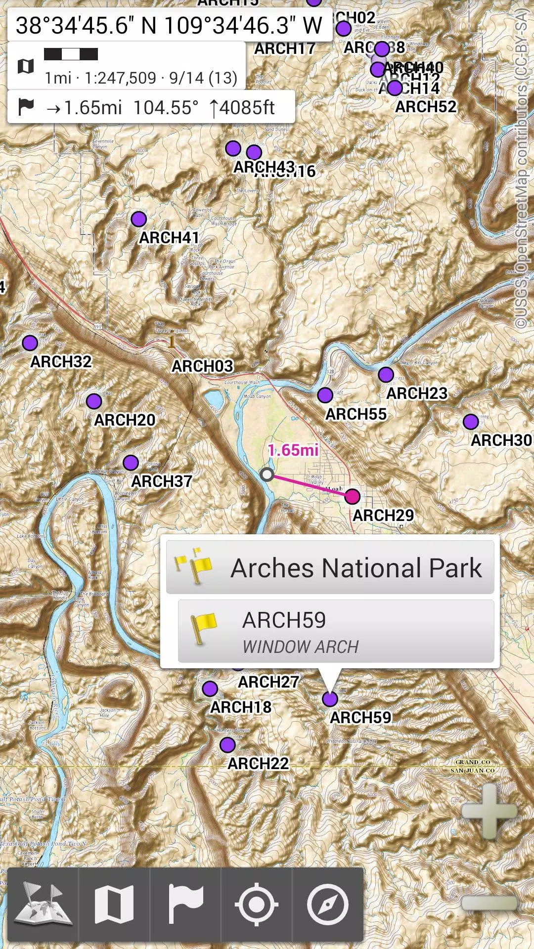
★★ Display, Store, and Retrieve Unlimited Placemarks ★★
Enhance your maps by adding various elements such as waypoints, icons, routes, areas, and tracks.
Manage these effortlessly with the efficient SD-Card Placemarks Explorer.
★★ On-Map GPS Location & Orientation ★★
Your precise location and direction are clearly shown on the map, which can rotate to align with your real-world orientation (depending on your device's capabilities).
Toggle GPS on and off easily to conserve battery life.
Additional features include:
• Choice of metric, imperial, or hybrid distance units;
• Multiple GPS coordinate formats like Latitude/Longitude, and grid systems such as UTM, MGRS, USNG, OSGB Grid, Irish Grid, Swiss Grid, Lambert Grids, DFCI Grid, QTH Maidenhead Locator System, and more;
• Import capability for hundreds of coordinate formats from https://www.spatialreference.org;
• Display of on-map grids;
• Full-screen map viewing;
• Multi-touch zoom functionality;
• And more...
★★ Need More? ★★
For the ultimate outdoor experience, explore AlpineQuest Off-Road Explorer, the comprehensive outdoor solution built on All-In-One OfflineMaps, featuring an advanced GPS Track Recorder and additional capabilities: https://www.alpinequest.net/google-play


- Terraria\'s Bigger and Boulder update offers new Palworld and Dead Cells crossover content 1 weeks ago
- Azul Board Game Prime Day Deal Highly Recommended 2 weeks ago
- Persona 4 Remaster Revealed in Xbox 2025 Event 2 weeks ago
- Mobirix Unveils Charming Merge Cat Town Puzzle Game 2 weeks ago
- The Walking Dead in Fortnite: New Studio Venture 2 weeks ago
- Roland-Garros eSeries 2025 crowns Tennis Clash champion 2 weeks ago
-

Personalization / 1.0.0 / by DigitalPowerDEV / 11.10M
Download -

Lifestyle / 1.5 / by BetterPlace Safety Solutions Pvt Ltd / 9.60M
Download -

Video Players & Editors / v1.02 / by TateSAV / 13.80M
Download -

Productivity / 2.8 / 10.16M
Download


-
 All Passwords and Padlock Combinations in Lost Records: Bloom and Rage
-
 30 best mods for The Sims 2
-
 Best Android PS1 Emulator - Which PlayStation Emulator Should I Use?
-
 Tokyo Game Show 2024 Dates and Schedule: Everything We Know So Far
-
 Leaked Footage Unveils Mythical Epic: Black Myth: Wukong
-
 Android welcomes "Dynasty Legends" style game, "Otherworld Three Kingdoms"